|

Counties: Archer, Baylor, Childress, Clay, Cottle, Dickens, Foard, Hall, Hardeman, Haskell, Jack, Kent, King, Knox, Montague, Motley, Palo Pinto, Parker, Stephens, Stonewall, Throckmorton, Wichita, Wilbarger, Wise, and Young. |
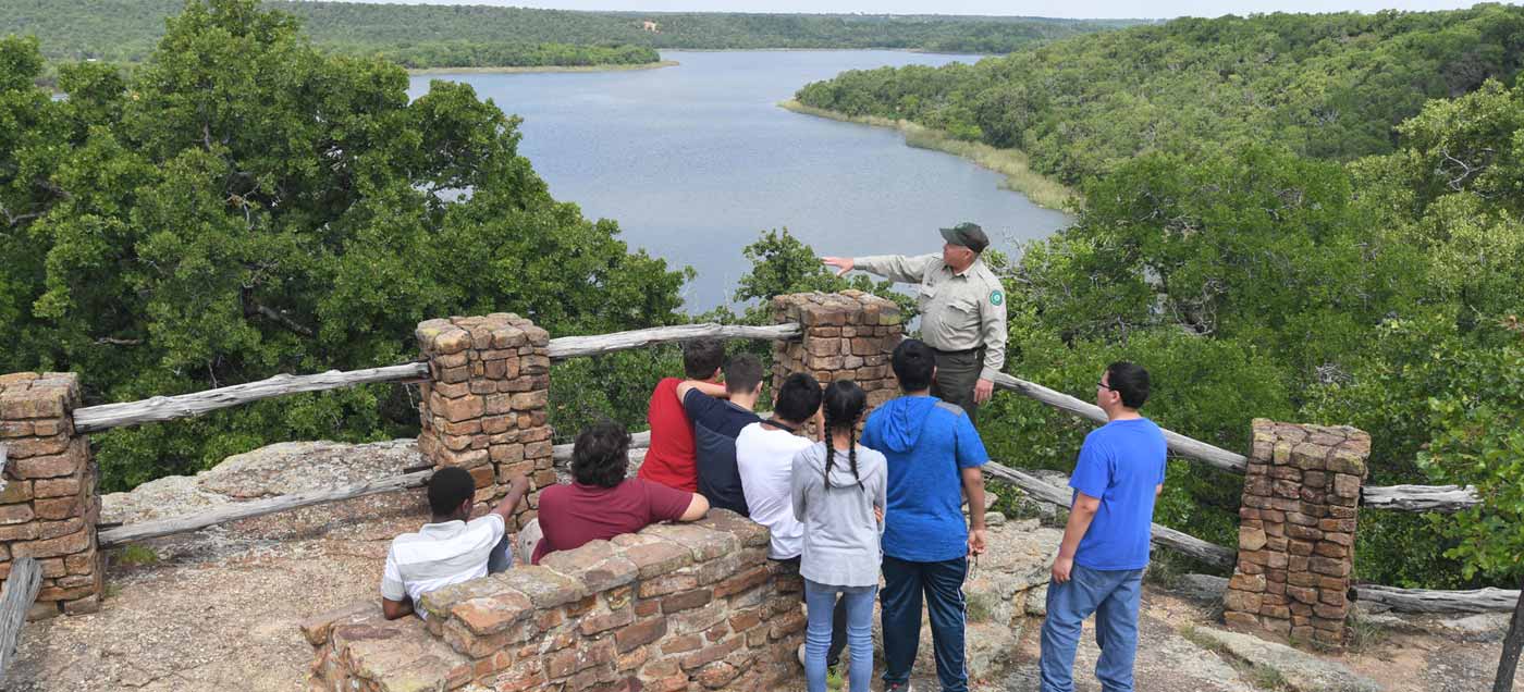
228 State Park Road 61 Jack County Located at Fort Richardson and Jacksboro, this 9-mile hike, bike and equestrian trail runs adjacent to Fort Richardson and along Lost Creek, which is the main watershed for the two city lakes. The trail follows scenic Lost Creek and travels the east side of Lake Jacksboro and Lost Creek Reservoir. The trail crosses the dam at Lost Creek Reservoir and winds along the west side until it reaches the trailhead. This is a linear trail system that winds with the terrain and abounds in scenic beauty. It travels through the park with many shaded areas of pecan and oak trees. Most of the trail travels by the creek or lakes which provide numerous opportunities to fish and swim. This is a beautiful trail, abundant also in wildlife and wildflowers. There is a trailhead at Fort Richardson State Park & Historic Site and a trailhead on Lost Creek Reservoir. https://www.nps.gov/gumo/planyourvisit/basicinfo.htm
| Lake Mineral Wells State Park 100 Park Road 71 Mineral Wells, TX 76067 Parker and Palo Pinto Counties Lake Mineral Wells State Park & Trailway sits in the heart of cattle country, near what was once a popular health resort. You will love the area’s history and scenery, but you’ll also enjoy the park’s outdoor amenities: a lake, a rock climbing area, and miles of trails. We are just 45 minutes west of Fort Worth – c’mon over! The Trailway is 20 miles long and 10 feet wide. Two miles of surface from the downtown Mineral Wells trailhead toward the east are asphalt. Finely crushed and screened limestone tops the remaining 18 miles.
| LBJ Grasslands Lyndon B. Johnson National Grassland is a National Grassland located in the Great Plains of the northern part of the U.S. state of Texas near Decatur and within an hour's drive from Fort Worth. In Decatur, TX, at the intersection of US Rt. 380 and FM Rt. 730, take ramp to stop sign. Turn left at stop sign onto Rt. 730 and go 9 miles to County Rt. 2461 sign. Turn left after sign onto Rt. 2461 and bear right immediately onto County Rt. 2560 for 2.4 miles to Tadra Point Trailhead sign. Turn left at sign onto Forest Rt. 900 (gravel) and go 1.8 miles to campground.
75-mile LBJ Multi-Use Trail System. |

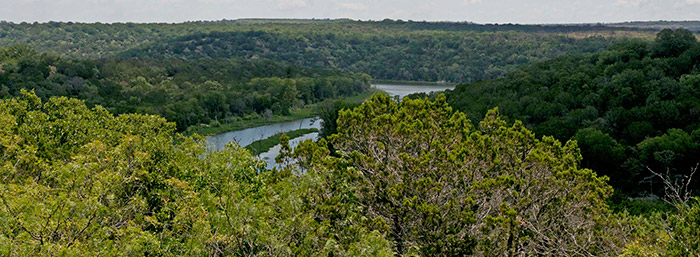
Palo Pinto Mountains State Park City of Strawn The new Palo Pinto Mountains State Park, which is located in southeastern Stephens County and southwestern Palo Pinto County, will be open to the public later this year, with an official grand opening scheduled for early 2024 Palo Pinto Mountains State Park is located in the Western Cross Timbers Ecoregion of North Central Texas. The new park offers a great diversity of topography, as well as a great variety of plants and wildlife. The park consists of 3,331 acres of land in the southwest corner of Palo Pinto County and extending into the southeast corner of Stephens County. The nearest town to the park is the picturesque community of Strawn, which will serve as the gateway to the park. The park is in the Western Cross Timbers Ecoregion, a designation given to us by the United States Environmental Protection Agency. The park property is home to various types of trees, including live oak, blackjack oak, Texas oak, post oak, Texas ash, prickly ash or tickle-tongue, cedar elms, and of course mesquite and cedar and ash juniper. And of course our wonderful native pecan trees.
|